Traprain Law
OS map Google map Back to all directions
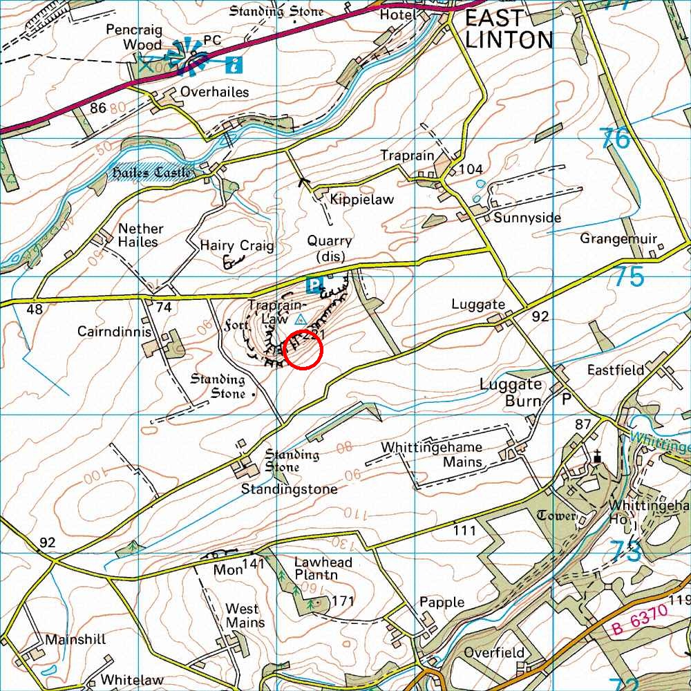
Map Ref         NT 583 742  (Landranger 67)
Lat/Long        55.959003, -2.668509
Distance        24 miles; 30 mins     (from the centre of Edinburgh)
-
Access:
The wall that used to run along by the access track has been demolished, and the new enlarged field is now being ploughed through in one go, but there is still a path to the crag along the old line (let me know if it disappears!).
Several years ago Mountaineering Scotland had the following information on their website but I do not know if this still applies (and it seems to have disappeared from the MS website):The East Lothian Access Officer has confirmed that the landowner has agreed that the public can continue to use the line of the original path even though the wall is no longer there. There is a faint walked route from the bend in the road to the stile and the landowner has been asked to make this more distinct. Please continue to use this route as the more people that use it, the more obvious it will become.
Leave Edinburgh along the A1. Leave the A1 at the second Haddington turn off (signposted East Linton), then follow the old A1 until just bypassing East Linton. There, turn off right and go through the hamlet of Traprain and do a few zig-zags on the road until you arrive at the crag. The crag is under the 221 spot height on the OS map below (in the red circle) or see the above OS link. Park near the gap in the wall at the bend in the road SSE of the crag (near the spot marked by the arrow on the OS map at the above link). Please do NOT block access to the field (the farmer regularly uses this entrance to the field, with some large agricultural vehicles!). Go through the gap in the wall and walk NNW, keeping to the obvious path through the field, to the obvious crag.
NB The normal climbing crag is on the south side of the Law. There is an old quarry on the north side (quite prominently visible from the A1), near the parking and picnic spot marked on the OS map. This quarry has some climbs, but the rock is loose and so this quarry is rarely visited.
You can also get there from the A1 by going through Haddington and along the back roads (this is a bit shorter, but the other way is simpler, and the old A1 has very little traffic on it).
The usual post-climbing pub is the Linton hotel in East Linton, on the road just below the marked PH on the OS map.