Dunkeld (Craig a Barns, Polney Crag)
OS map Google map Back to all directions
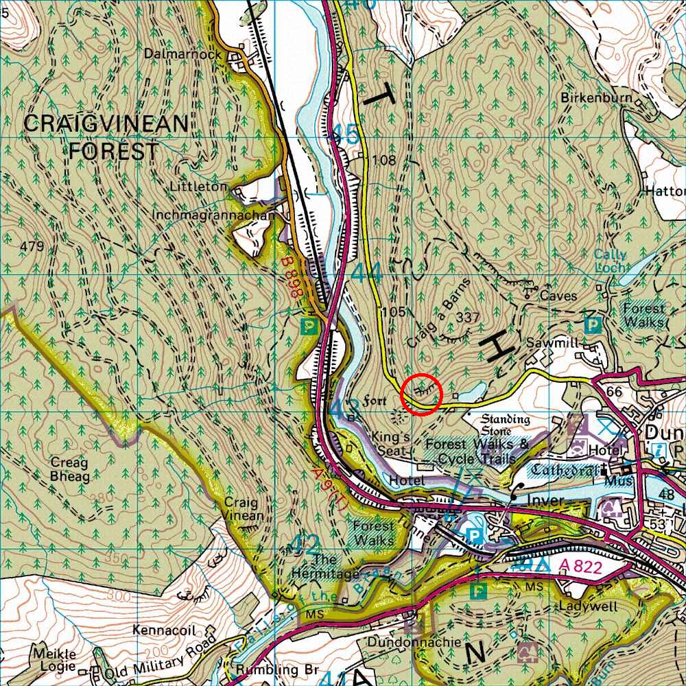
Map Ref         NO 009 430 (Landranger 52, 53)
Lat/Long        56.568991, -3.611057
Distance        60 miles; 1 hour, 20 mins     (from the centre of Edinburgh)
Drive up the A9, past Perth and after about 58 miles turn right into Dunkeld. Go straight through Dunkeld and keep left after leaving it. After about a mile, just before the road starts curving to the right, there are two areas of roadside parking on the grass on the right, at about the spot marked by the arrow on the OS map (bump up over the kerb). There is a turning spot at a gate on the right, at the start of a track, about 200 yards after the parking spots, and round a curve in the road (the track is shown on the OS map). When parking and leaving, watch out for fast moving traffic coming round the bend. I usually turn before parking.
From the parking spots various paths go up steeply to the crag. From the left parking spot (facing in) you arrive near Kestrel Crack, while from the right you arrive near to Hairy Gully, both in the Main Cliff area.