Berryhill
OS map Google map Back to all directions
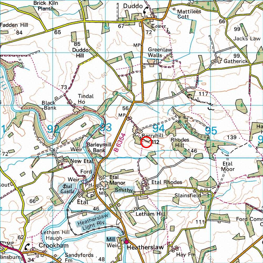
Map Ref         NT 938 403  (Landranger 75)
Lat/Long        55.656636, -2.099304
Distance        62 miles; 1 hour, 15 mins     (from the centre of Edinburgh)
The crag lies roughly mid way between Wooler and Berwick, close to the village of Etal. About 1 mile north of Etal on the B6354, a farm lane leads off to the east. Parking is available on the side of the lane before the main farmhouse is reached. The top of the crag lies beyond the farm and can be reached in 5 minutes. It is essential that all visiting climbers ask permission at the farm before proceeding to the crag. It is highly unlikely that there will be a refusal but the approach routes may differ from time to time depending on the operational requirements of the farm.