Aberdour (Hawkcraig)
OS map Google map Back to all directions
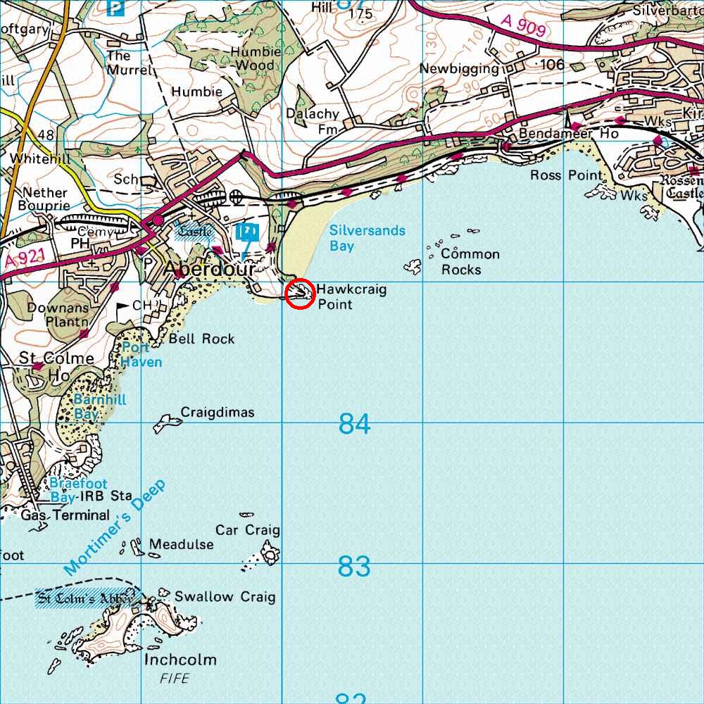
Map Ref         NT 200 849 (Landranger 66)
Lat/Long        56.050310, -3.284601
Distance        19 miles; 35 mins     (from the centre of Edinburgh)
Cross the Forth bridge, leave the M90 motorway at the second exit after the bridge, signposted A985/A921, and then turn right under the motorway, then follow the signs for Aberdour, entering it along the A921. Follow this through Aberdour until you can turn right along the road heading for the Silver Sands beach - head for the blue P marked on the map. Don't go into the car park, follow the road to the left which drops down towards the beach (and a second car park), then curves round to Hawkcraig Point. Stop here (if you don't you will drive off the cliffs).
To get to the cliffs from the car park, walk towards the sea and then swing right along a vague track leading to a steep but easy 6 metre downclimb past an obvious perched block, immediately adjacent to the cliffs
(at the top of the downclimb you should be looking along the rocky seashore, past the first few climbs, not out to sea).
Then walk along the rocky seashore to the climbs.
It is also possible, and many people do it, to get to the crag by getting the train to Aberdour station and then walking. The walk is about 1 mile. For train times see National Rail Enquiries or Trainline; google maps (see above) shows how to walk to the crag.